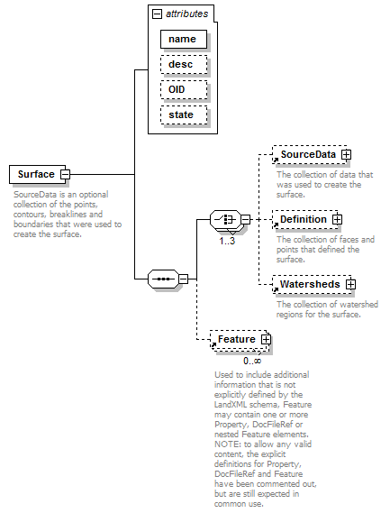
| diagram |  |
||||||||||||||||||||||||||||||
| namespace | http://www.landxml.org/schema/LandXML-1.2 | ||||||||||||||||||||||||||||||
| properties |
|
||||||||||||||||||||||||||||||
| children | SourceData Definition Watersheds Feature | ||||||||||||||||||||||||||||||
| used by |
|
||||||||||||||||||||||||||||||
| attributes |
|
||||||||||||||||||||||||||||||
| annotation |
|
||||||||||||||||||||||||||||||
| source | <xs:element name="Surface"> <xs:annotation> <xs:documentation>SourceData is an optional collection of the points, contours, breaklines and boundaries that were used to create the surface.</xs:documentation> <xs:documentation>Definition is a collection of points and faces that define the surface.</xs:documentation> <xs:documentation>Watersheds is a collection the watershed boundaries for the surface.</xs:documentation> </xs:annotation> <xs:complexType> <xs:sequence> <xs:choice maxOccurs="3"> <xs:element ref="SourceData" minOccurs="0"/> <xs:element ref="Definition" minOccurs="0"/> <xs:element ref="Watersheds" minOccurs="0"/> </xs:choice> <xs:element ref="Feature" minOccurs="0" maxOccurs="unbounded"/> </xs:sequence> <xs:attribute name="name" type="xs:string" use="required"/> <xs:attribute name="desc" type="xs:string"/> <xs:attribute name="OID" type="xs:string"/> <xs:attribute name="state" type="stateType"/> </xs:complexType> </xs:element> |
attribute Surface/@name
| type | xs:string | ||||
| properties |
|
||||
| source | <xs:attribute name="name" type="xs:string" use="required"/> |
attribute Surface/@desc
| type | xs:string | ||
| properties |
|
||
| source | <xs:attribute name="desc" type="xs:string"/> |
attribute Surface/@OID
| type | xs:string | ||
| properties |
|
||
| source | <xs:attribute name="OID" type="xs:string"/> |
attribute Surface/@state
| type | stateType | ||||||||
| properties |
|
||||||||
| facets |
|
||||||||
| source | <xs:attribute name="state" type="stateType"/> |
XML Schema documentation generated by XMLSpy Schema Editor http://www.altova.com/xmlspy